This Drone Sees Through Trees!
- Victoria Knoll

- Jul 14, 2020
- 2 min read
A look at measuring vegetation penetration for bare earth modeling via UAS LiDAR presented by Indiana Drones

Flying the Ozark Mountains

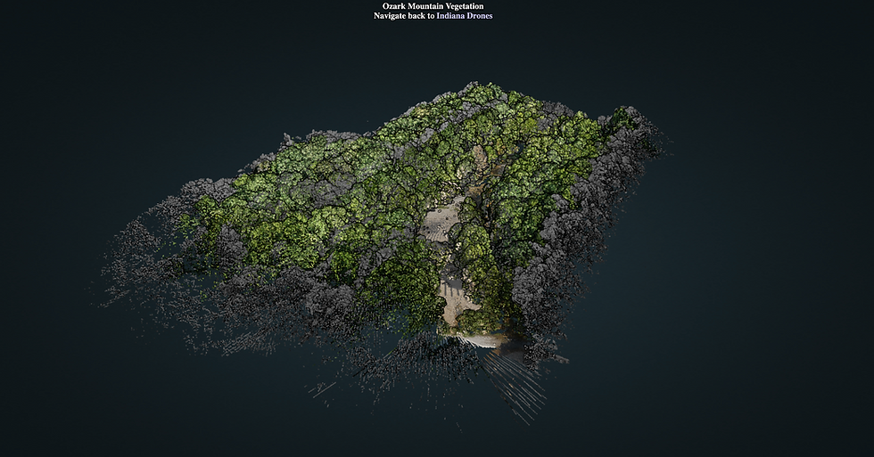
Let’s fly with Indiana Drones on this most recent installment as he explores the Ozarks to demonstrate the effectiveness of using an unmanned aircraft system with LiDAR to create a bare earth model. The challenge is real as Indiana is tasked with tackling the dense Ozark foliage to determine what lies beneath the tree canopies and brush. Traditional land surveying would have workers walking the forest floor requiring more time, more manpower and more risk of injury. Indiana Drones shows us how to make a bare earth model in record time and with record accuracy from the air. In this video, Indiana showcases the Emlid GNSS receivers, Reigle Minivux and the DJI M-600 to capture and analyze impressive data that can be used for projects such as hydrological mapping or imported into CAD designs by engineering firms.
Vegetation Penetration
So, just how does a drone flying with a LiDAR system see through the trees? The answer is rooted in the principle of multiple returns. The analogy Indiana Drones uses in the video is the filtering of the sun through trees and brush until some of the rays finally hit the ground. Another way to picture this is to think of a single pulse from the LiDAR system as a flashlight beam: the beam begins narrowly, hitting just one or two leaves and then the beam broadens as it travels towards the ground, eventually shedding a portion of its light on the bare ground. Once the pulse hits an object, it is reflected back up to the sensor on the LiDAR system and a measurement is recorded. Each time the laser pulse hits an object and reflects back to the LiDAR system is known as a “return”.


The LiDAR used in this video emits 100,000 laser pulses per second and each pulse results in up to 5 returns. This means that there are up to 500,000 points of data returned each second during a flight to build an amazingly precise map that includes all levels of the targeted topography such as the tree canopy, water ways, land structures and the desired bare earth model. This level of detailed data collection is unheard of with traditional land survey!
If you enjoyed this post and watching Indiana Drones’s latest video, please subscribe on Indiana Drones YouTube Channel and sign up for the newsletter on www.theindianadrones.com.


This drone that can see through trees is seriously mind-blowing! It opens up so many possibilities for exploring hard-to-reach areas and capturing unique shots. If you're looking to edit footage from such a cool drone, https://www.movavi.com/imovie-for-windows/ is a solid tool. It’s user-friendly and allows you to fine-tune your clips, making those aerial views even more impressive.